Road crashes in the European Union using a Geographical Information System (GIS).
A map user guide is available to describe the layout and contents of the following thematic maps.
The Road Safety Atlas is the European Road Accident Map Viewer of the European Commission. It supports interactive maps display and satellite overlays. It provides a user-friendly interface to discover up to date road safety indicators for European countries. Information is structured by themes.
Filter by
Map library (104)
RSSShowing results 70 to 80
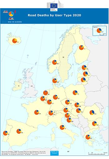
Road Deaths by User Type
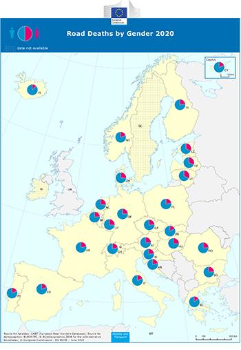
Road Deaths by Gender
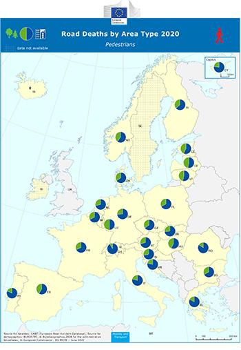
Road Deaths by Area Type Pedestrians
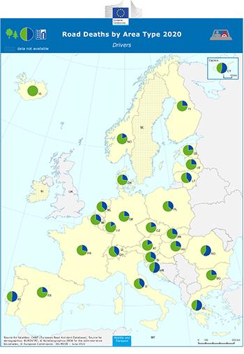
Road Deaths by Area Type Drivers
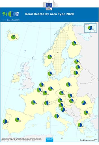
Road Deaths by Area Type

Road Deaths by Age Group Outside Built-Up Areas
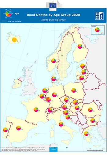
Road Deaths by Age Group Inside Built-Up Areas
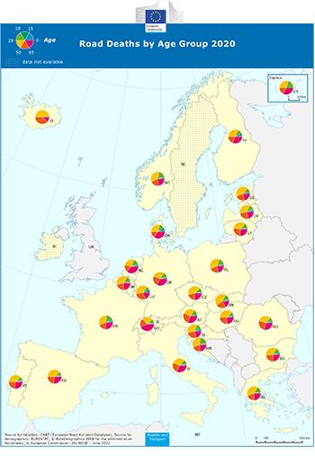
Road Deaths by Age Group
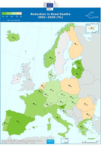
Reduction in Road Deaths 2001–2020 %
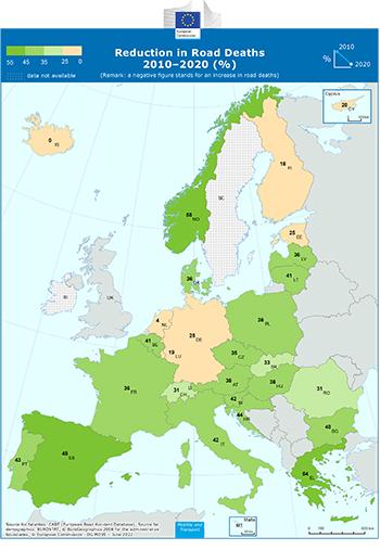
Reduction in Road Deaths 2010–2020 (% )