Road crashes in the European Union using a Geographical Information System (GIS).
A map user guide is available to describe the layout and contents of the following thematic maps.
The Road Safety Atlas is the European Road Accident Map Viewer of the European Commission. It supports interactive maps display and satellite overlays. It provides a user-friendly interface to discover up to date road safety indicators for European countries. Information is structured by themes.
Filter by
Map library (1837)
RSSShowing results 1080 to 1090
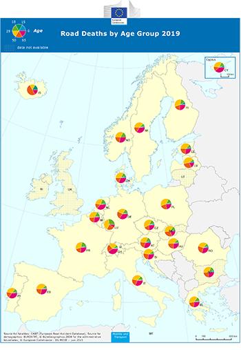
Road Deaths by Age Group
mapcare_age_2018.pdf
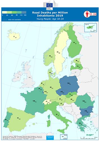
Road Deaths per Million Inhabitants - Youngsters: Age 18-24
mapcare_age1824_2018.pdf
lillehammer08_final_report.pdf
isa_faqs_2013.pdf
staff_working_document.pdf
interim_eval.pdf
injury_next_steps.pdf
conference_13_june_2014.pdf