Road crashes in the European Union using a Geographical Information System (GIS).
A map user guide is available to describe the layout and contents of the following thematic maps.
The Road Safety Atlas is the European Road Accident Map Viewer of the European Commission. It supports interactive maps display and satellite overlays. It provides a user-friendly interface to discover up to date road safety indicators for European countries. Information is structured by themes.
Filter by
Map library (1837)
RSSShowing results 1250 to 1260
mapcare09_gender_2005.pdf
mapcare09_gender_2001.pdf
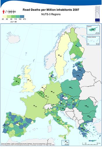
Road Deaths per Million Inhabitants - NUTS-3 Regions
mapcare09_fataln3_2005.pdf
mapcare09_fataln3_2001.pdf
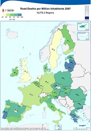
Road Deaths per Million Inhabitants - NUTS-2 Regions
mapcare09_fataln2_2005.pdf
mapcare09_fataln2_2001.pdf
mapcare09_fatal_2007.pdf
mapcare09_fatal_2005.pdf