Road crashes in the European Union using a Geographical Information System (GIS).
A map user guide is available to describe the layout and contents of the following thematic maps.
The Road Safety Atlas is the European Road Accident Map Viewer of the European Commission. It supports interactive maps display and satellite overlays. It provides a user-friendly interface to discover up to date road safety indicators for European countries. Information is structured by themes.
Filter by
Map library (1865)
RSSShowing results 200 to 210
ff_roads_inside_urban_areas_20220707.pdf
ff_road_outside_urban_areas_20220707.xlsx
ff_gender_20220707.xlsx
ff_gender_20220706.pdf
ff_children_20220707.xlsx
Monitoring report July 2022 XLS
Monitoring report July 2022 PDF
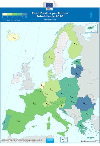
Road Deaths per Million Inhabitants - Pedestrians
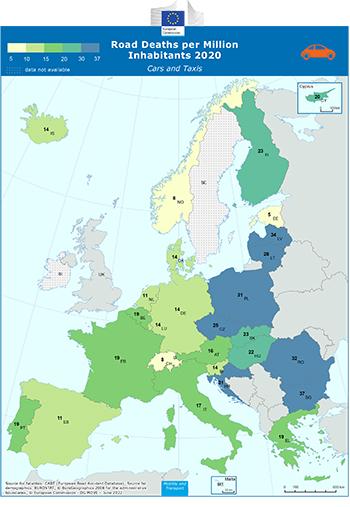
Road Deaths per Million Inhabitants - Cars and Taxis
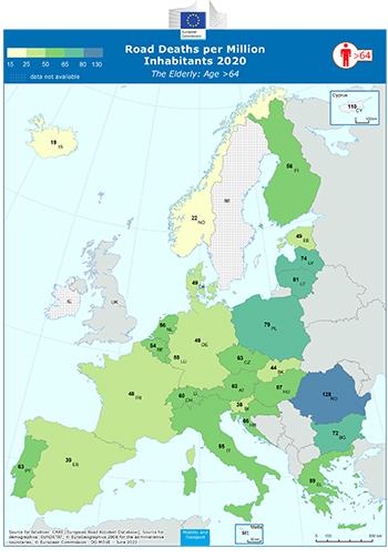
Road Deaths per Million Inhabitants - The Elderly: Age >64