Road crashes in the European Union using a Geographical Information System (GIS).
A map user guide is available to describe the layout and contents of the following thematic maps.
The Road Safety Atlas is the European Road Accident Map Viewer of the European Commission. It supports interactive maps display and satellite overlays. It provides a user-friendly interface to discover up to date road safety indicators for European countries. Information is structured by themes.
Filter by
Map library (1865)
RSSShowing results 20 to 30
Facts & Figures: Pedestrians (Dataset 2024)
Facts & Figures: Pedestrians (Report 2024)
Facts & Figures: Powered two wheelers (Dataset 2024)
Facts & Figures: Powered two wheelers (Report 2024)
Facts & Figures: Regional Distribution (Dataset 2024)
Facts & Figures: Regional Distribution (Report 2024)
Facts & Figures: Single vehicle crashes (Dataset 2024)
Facts & Figures: Single vehicle crashes (Report 2024)
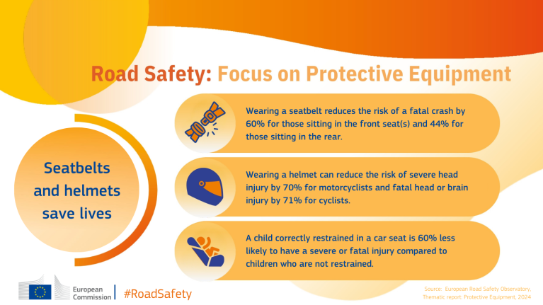
Road Safety infographic: Focus on Protective equipment
Facts & Figures: Road safety protective equipment (Report 2024)